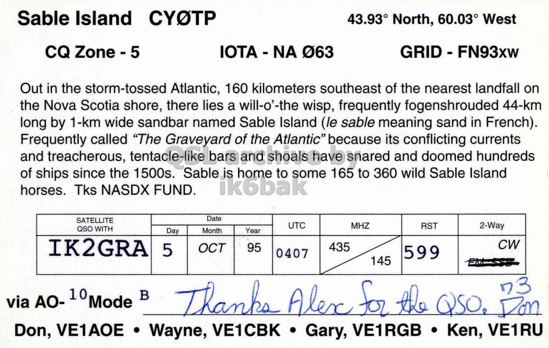
CY0TP QSL card to IK2GRA

on October 5, 1995

Front QSL card, of CY0TP to IK2GRA, October 5, 1995, CW mode. The QSL image contains the following objects: Land, Nature, Outdoors, Sea, Water. And contains this text: by.
Right QSL card, of CY0TP to IK2GRA, October 5, 1995, CW mode. And contains this text: 43.93° North, 60.03° West CQ Zone - 5 Out in the storm-tossed Atlantic, 160 kilometers southeast of the nearest landfall on the Nova Scotia shore, there lies a will-o'-the wisp, frequently fogenshrouded 44-km long by 1-km wide sandbar named Sable Island (le sable meaning sand in French). Frequently and treacherous, called "The Graveyard of the Atlantic" because snared its and conflicting doomed currents hundreds of ships since the Sable home 165 360 wild Sable Island 1500s. to to some horses. Tks NASDX FUND. ik6bak Date SATELLITE UTC MHZ RST 2-Way QSO WITH Day Month Year Sable Island 43.93° North, 60.03° West CQ Out in the storm-tossed Atlantic, 160 kilometers southeast of the nearest landfall on the Nova Scotia shore, there lies a will-o'-the wisp, frequently fogenshrouded 44-km long by 1-km wide sandbar named Sable Island (le sable meaning sand in French). Frequently and treacherous, called "The Graveyard of the Atlantic" because snared its and conflicting doomed currents hundreds of ships since the Sable home 165 360 wild Sable Island 1500s. to to some horses. Tks NASDX FUND. ik6bak Date SATELLITE UTC MHZ RST 2-Way QSO WITH Day Month Year.